66231
- TitleSeries 09: Irrigation, ca. 1921-1924
- Call numberPXB 310/241-271
- Level of descriptionseries
- Date
ca. 1921-1924 - Type of material
- Reference code66231
- Issue CopyDigitised
- Physical DescriptionPhotographs - 31 silver gelatin photoprints - 16.5 x 15 cm.-16.7 x 21.5 cm.
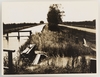
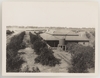
- Scope and Content241. On Murrumbidgee Irrigation Area, N.S.W.
242. Mixed farming, Murrumbidgee Irrigation Area, N.S.W.
243. Yanes Irrigation Area, N.S.W.
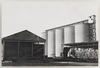
244. Wheat silos at a N.S.W. country railway station
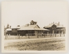
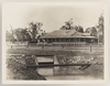
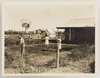
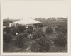
245. Settler's home, Murrumbidgee Irrigation Area
246. Irrigation Murrumbidgee, N.S.W.
247. Settler's home, Murrumbidgee Irrigation Area, N.S.W.
248. Orchardist's home, Murrumbidgee Irrigation Area, N.S.W.
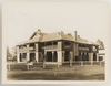
249. Administrative headquarters, Murrumbidgee Irrigation Area, N.S.W
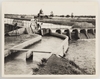
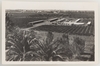
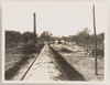
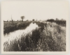
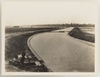
250. Main concrete channel crossing creek, Murrumbidgee Irrigation Area, N.S.W.
251. Fruit farm, Leeton, N.S.W.
252. Making a home in the bush, Springfield, Tasmania
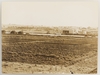
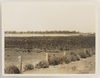
253. Reclaimed swamp land, Murray River, S.A.
254. Berri Irrigation Area, River Murray, S.A.
255. Captain Miers Block at Mildura
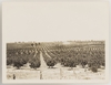
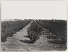
256. 2 year old irrigated vineyard, Red Cliffs, Mildura, Vic.
257. Building Rising Main, Pumping Station in course of erection, Red Cliffs Irrigation Area near Mildura, Vic.
258. Irrigation channel, Vic.
259. Irrigation in the orchard, Vic.
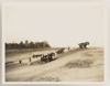
260. Main Channel in course of construction, Red Cliffs Irrigation Area near Mildura, Vic.
261. Irrigation channel, Tatina, Vic.
262. 2 year old block of sultanas & currants, Red Cliffs, Mildura, Vic
263. Drying arrowroot, Queensland
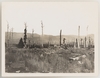
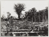
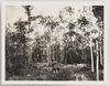
264. Clearing palm scrub, Ingham District, Qld.
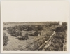
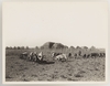
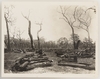
265. Ground partly cleared, timber stacked for burning
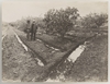
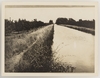
266. Channel (irrigation)
267. Govt experimentation orchard, Berri Irrigation area, River Murray
268. Lake View Branch canal showing Dethridge Meter
269. Clearing land for cotton cultivation
270. Irrigation
271. 10 acre farm showing road electric light & power standards, means of access to farm - Copying ConditionsOut of copyright: Created before 1955.
- General note
Digital order no:Album ID : 936597 - Signatures / Inscriptions
Most of the photographs are annotated on reverse - Subject
- Topic
- Place
- Exhibited in
Impact: a changing land - State Library of New South Wales. Applies to: Nos. 90 ; 247 - Open Rosetta viewer
View Media Files
2. 
3. 
4. 
5. 
6. 
7. 
8. 
9. 
10. 
11. 
12. 
13. 
14. 
15. 
16. 
17. 
18. 
19. 
20. 
21. 
22. 
23. 
24. 
25. 
26. 
27. 
28. 
29. 
30. 
31. 
- Browse collection hierarchy
- Manuscript Index
- A
- B
- C
- D
- E
- F
- G
- H
- I
- J
- K
- L
- M
- N
- O
- P
- Q
- R
- S
- T
- U
- V
- W
- X
- Y
- Z